


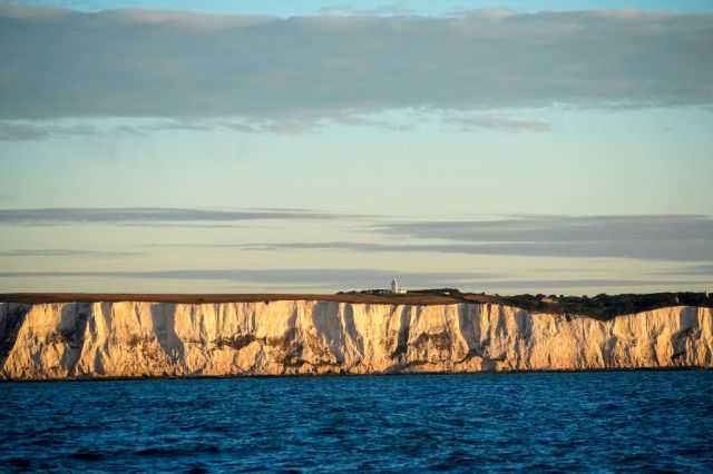
The ancient kingdom of Kent. Photo by Christopher Furlong/Getty Images


From the Peasants’ Revolt to the Battle of Britain, tyrants have discovered that the Garden of England conceals sharp thorns. Even William the Bastard thought it wise to do a deal with the locals instead of fighting them. To this day, the county’s motto is Invicta — unconquerable.
Unfortunately, our present government is less discerning. The whole of Kent has been placed under Tier 3 Covid restrictions — meaning that the end of lockdown barely makes a difference. That’s also true of other parts of the country, but Kent has particular reason to feel aggrieved. Having gone into lockdown as a Tier 1 area, it’s emerged at the other end of the scale.
For some people, this is proof positive that lockdowns don’t work. The real problem, though, is the precise opposite — the surge of infections seen in one corner of the county has not spread to anything like the same extent. Indeed, in some areas there are so few cases that the figures have to be disguised to stop particular individuals from being identified.
In case you don’t know Kent very well, it’s pretty big — 50 miles plus from one side to the other. It borders London at one end, but is closer to Calais at the other. It’s also home to 1.8 million people. That’s more than four EU member states (or six, if you were to return the London boroughs of Bromley and Bexley to their Kentish homeland).
Kent also contains a whole country’s worth of sociological differences. Picture perfect villages contrast with struggling coastal towns; and built-up suburbs with sparsely populated marshland. And just compare bourgeois Tunbridge Wells, which voted to remain, with Brexity Thanet, which, at one point, had a UKIP-controlled district council. Nigel Farage, born in Farnborough, is a quintessential Kentishman; but then so was Ted Heath, born in Broadstairs. The county is both closely connected to the Continent (literally, thanks to the Channel Tunnel), but also sticks two fingers up to it.
Fierce and gentle, rebellious and conservative, poor and prosperous, the dualities of the county find an echo in the distinction between Kentish Men and Men of Kent. Today, those labels refer to the western and eastern parts of the county; but there was once a class connotation too — the Men of Kent being grander than the mere Kentish Men.
In short, Kent contains multitudes. Unfortunately, that hasn’t stopped the Government from treating the county as an undifferentiated blob. Which is weird, because elsewhere the map of tiers has been drawn in finer detail. For instance, Slough is in Tier 3, but not the rest of Berkshire which is in Tier 2.
So why the geographical blunderbuss in one county and not the other?
Perhaps it’s because Berkshire doesn’t exist — at least not for administrative purposes. Berkshire County Council was abolished in 1998 and turned into a series of unitary authorities. However, Kent — like most of England — was left largely as it is. With the exception of Medway, Kent County Council remains the highest tier of local government.
An absurd possibility therefore presents itself — which is that the Covid tiers were assigned by some bureaucrat reading down a list of highest-level local authorities and making no allowance for their greatly varying sizes. But can that really be the explanation? They surely can’t have locked-down nearly two million people just because of a historical quirk of political geography, can they?
It’s hard to tell, because the Government won’t properly explain the rationale for the new tiers. As a result temperatures are rising; mild-mannered MPs like Damian Green, Greg Clark and Tom Tugendhat are on the warpath. And who can blame them? If the ministers can’t justify an apparently nonsensical decision then they deserve all the Kentish pitchforks heading their way.
At this point, I ought to state that I’m not reflexively anti-lockdown. If there’s a firm scientific basis for any anti-Covid measure, then so be it. I also think we ought to be tolerant of the mistakes that are bound to be made in such extraordinary circumstances. Our leaders are only human after all. However, when a mistake had been identified, it ought to be corrected. Kent MPs have already alerted the government to its geographical illiteracy, pleading with ministers to set tiers by district and borough, not by county. It’s an eminently sensible idea — so why has it been ignored?
As a Kentish Man, I’ve been entertaining doubts — not just about Covid policy or government competence, but also about something of longer-lasting significance: the entire county system. Indeed, I’m coming to the conclusion that this literally medieval arrangement is doing serious harm to the governance of England in the 21st century.
This is a painful realisation. For a cultural conservative like me, county-scepticism isn’t just unorthodox, it’s downright heretical. Our ancient counties aren’t called ancient for nothing — they go back to the early Middle Ages, and some of them to Dark Ages. Kent, for instance, was one of the seven Anglo-Saxon kingdoms of the Heptarchy. So why on earth would I want to get rid of that much history? What could be more redolent of a bloodless, bureaucratic mindset than erasing age-old traditions to make way for something more “rational”? I mean, that’s the sort of thing the French would do. Indeed, they have done it — many times. Parisian technocrats are forever tinkering with the internal borders of France.
Ironically, it was the French who gave us the term counties — or comtés — in the first place, replacing the older shires. Originally, a county was a jurisdiction governed by a count — a title derived from a Latin word meaning ‘companion’ (to a king). In England, we replaced the word “count” with “earl” for reasons of delicacy, but “counties” remained.
Over the centuries they took on various administrative functions — and in the Victorian era they became the main engine of local democracy. Except that it’s long been obvious that the county map doesn’t correspond to the geography of the modern world. Urbanisation has disrupted older patterns of settlement; in some cases, county borders that once ran through the back-of-beyond, were enveloped by growing towns and cities. Royal Tunbridge Wells is the classic example: 400 years ago it didn’t exist, but then a spring was a discovered and the famous spa grew up around it, in time becoming bigger than its parent town, Tonbridge. Inconveniently, though, the Kent-Sussex border chopped the new town in half.
Borders can be moved, of course — which is what eventually happened in Tunbridge Wells. However, such tweaks only kick the can down the road. Indeed, road and rail links have changed the old rules of geography, shrinking distances and creating hubs that extend far beyond irrelevant old boundaries. For instance, the Dartford Tunnel means that the two shores of the Thames Estuary have drawn closer together.
Thanks to a shared environment and their mutual proximity to London, they have things in common that don’t apply the rest of their respective counties (Kent and Essex). The same can be said of the Kent-Sussex border. Now that the Weald is no longer an impenetrable wilderness, but a throughly civilised Area of Outstanding Natural Beauty, there’s no real distinction between the communities on either side of the invisible line.
In the post-war period, reorganisations of local government tried to catch up with the new realities. Of course, they failed because they were micromanaged from the top-down. Traditional counties like Middlesex and Rutland were abolished and artificial creations like Avon and Humberside imposed on unwilling residents. In any case, the real power stayed in Whitehall.
Subsequent reforms were also bungled. Margaret Thatcher left Greater London and Greater Manchester without effective city-wide government. Tony Blair’s attempt at English regional government was an embarrassing flop. David Cameron and George Osborne made some progress with the City Deals and Metropolitan Mayors, but then they drove their reforms up a dead end. That’s because they tried to impose the same model they used in the cities on other parts of the country and it just didn’t fit. While a city is an organic whole, a non-metropolitan area containing a similar number of people is just too big and incoherent.
Power must be localised, but only to communities that actually exist — and those are defined by observable everyday experience. Where do people send their kids to school? Where do they go for the big weekly shop? Where to go to church or walk the dog? This is real human geography — the places that people call home and therefore actually care about. Things like travel-to-work-areas may sound coldly functional, but they reflect the rhythms of life. They also define housing markets and hence planning policy — the most important role of a meaningful local democracy.
In England, devolution is stuck, because our messed-up map of local government has got in the way. In particular, county councils suck decision-making power away from where it ought to be exercised. They are too big to be local, but too small to take on major infrastructure projects currently controlled by Whitehall. And, as we’ve seen with the Kent Covid fiasco, the county system encourages central government to impose one-size-fits-all decisions on places that have little to do with one another.
What about identity, though? Don’t counties add to the richness of our national life? Well, yes, up to a point, they do. But not a very significant point — not compared to the other things we identify with. Cross from one home to another, one town to another, one nation to another — and the differences are all-important. Cross a county line, however, and nothing much changes. If it weren’t for the road signs, you probably wouldn’t notice. Even postcodes carry more emotional resonance, in London at least.
I’m not saying that county-based variations in dialect and custom don’t matter. They’ve been much eroded, but let’s hold on to what we can. I love the pageantry of counties too. When I see the flag of Kent — a rearing white horse on a red background — I feel a flutter of pride. Some county flags may be of rather more recent vintage, but ancient traditions are of great value, even if they were invented last Tuesday.
There’s no reason why we can’t keep the ceremonial counties, with their lords-lieutenant and high sheriffs. In fact, we ought to restore the old boundaries — bringing back long-lost counties like Westmorland. Free of any administrative significance, it would be easily done.
As with the monarchy, a clear distinction between the efficient and dignified parts of the constitution would allow us to enjoy the symbolism and ritual of the past, without constraining the present. Counties should be like our surviving castles and manor houses — lovely to look at and of zero relevance to contemporary decision-making.
We can keep our heritage, but we don’t have to be governed by it. Especially when it means the difference between being allowed out of our homes or not.
Peter Franklin is Associate Editor of UnHerd. He was previously a policy advisor and speechwriter on environmental and social issues.
 peterfranklin_
Join the discussion
Join like minded readers that support our journalism by becoming a paid subscriber
To join the discussion in the comments, become a paid subscriber.
Join like minded readers that support our journalism, read unlimited articles and enjoy other subscriber-only benefits.
Subscribe